

A glacier collapse on the Nepal–China border unleashed a debris-charged flood that killed hundreds and wiped out entire valleys, according to updated scientific and official reports.
Story Highlights
- U.S. Geological Survey says a glacial collapse, not an earthquake, triggered the disaster.
- Rescuers report hundreds dead and missing across northern Nepal.
- Satellite and expert reviews support a massive ice-and-rock fall starting the cascade.
- Nepal’s disaster agency ties the flood to the Lhende River near the border.
What Authorities Say Happened
United States Geological Survey analysts reviewed seismic data and satellite images and reclassified the event as a glacial collapse and debris flow, not a magnitude 4.4 earthquake. The collapse set off a powerful surge of water, mud, and rock that tore down narrow valleys in northern Nepal. The force was strong enough to register like a quake at first, which led to confusion during the first reports before the agency updated its findings.
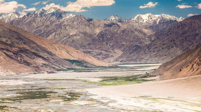
Reuters reported that a large wall of mud and rock fell into a river along the Nepal–China border, which triggered the flood on the Nepali side. The wave rushed downstream, destroying bridges, roads, and villages in its path. Early assessments by scientists point to a huge piece of glacier ice breaking off from high elevation and plunging thousands of feet to the valley floor, where it mixed with rock and soil and then thundered downriver.
Human Toll and Search Efforts
Rescue teams in Nepal recovered over one hundred bodies within the first day and kept searching for many more people swept away by the flood. Officials and reporters described hundreds dead and missing, with the count rising as teams reached remote areas. Families sought news of relatives while police and army units cleared roads and set up temporary shelters. Reporters also noted missing foreign tourists, which added pressure on responders to widen the search zone.
Nepal’s National Disaster Risk Reduction and Management Authority described the surge as a glacier-linked flood in the Lhende River. The agency said a landslide near the Nepal–China border crossing fed the torrent. That track aligns with field observations of heavy debris and with satellite checks that show fresh scars in the source area. Officials warned that unstable slopes and blocked channels could pose new risks as crews work downstream.
How a Glacier Collapse Turns Into a River Disaster
Scientists who reviewed images and terrain models said the likely chain began with an enormous ice-and-rock fall from a glacier at high altitude. That mass drop slammed into the valley, scooped up more water and debris, and blasted through narrow gorges. The moving mix traveled fast and hit towns and work sites before many people could flee. That kind of cascade can look like a normal flood, but the energy and debris load make it far more destructive.
United States Geological Survey data help explain why instruments first read a quake. A collapse that large releases seismic energy as it crashes down, which can mimic a small earthquake on monitors. Later checks of wave patterns and clear before-and-after satellite images allowed analysts to correct the record. That update matters for warnings and for planning safer projects in mountain zones prone to ice and rock failures.
Why This Region Faces Repeated Hazards
Himalayan valleys face complex flood risks tied to ice, rock, steep slopes, and lakes. Past research on Nepal shows that some deadly surges were not simple river floods. They were chains of events that mixed glacier ice, rockfalls, and sudden releases of stored water. Those differences matter for how leaders assess risk, plan roads and power dams, and train local teams to spot early danger signs and evacuate faster.
What Actually Triggered the Nepal–Tibet Border Flash Flood?
A massive ice and rock avalanche from a glacier triggered a chain reaction near the Nepal–China border. The avalanche and debris blocked the river, forming a temporary barrier lake. When the blockage gave way, a… pic.twitter.com/6ug3UUMKcN
— Pradnya (@PradnyaNayan) August 27, 2026
Reporters and scientists agree on the core in this case: a major glacier-linked collapse set off the flood. Some details remain under review, such as the precise trigger for the initial break and the exact balance of ice, rock, and water in the surge. That kind of uncertainty is common in the first days after a mountain disaster. Officials say more field checks and image analysis will sharpen the timeline and the map of damage.
Why It Matters Beyond Nepal
American readers have seen this pattern before: early alerts get facts wrong, and then experts revise the record. Here, fast correction by the United States Geological Survey helped point local leaders toward the real risk. That is the kind of clear, accountable public service people expect but often do not get. In a world of tight budgets and finger-pointing, basic competence in science and rescue work still saves lives and money when nature hits hard.
Sources:
youtube.com, apnews.com, nytimes.com, nampa.org, bbc.com, abcnews.com, portals.iucn.org
© conservativefreepress.com 2026. All rights reserved.